Search This Blog

Showing posts with label September 2013. Show all posts

Friday, 11 October 2013

PORT GERMEIN and PORT PIRIE SA

  I have travelled from Fitzgerald Bay on the NW coast of the Eyre Peninsula via Port Augusta to Port Germein on the upper West side of the Yorke Peninsula. This tiny fishing village has one claim to fame, a wooden jetty that once was the longest in the Southern Hemisphere. Originally 1.7 kilometres, I understand its length today is about 1.5 kilometers having been shortened by storms and other damage over time. It was low tide when i visited and it certainly goes out a long way hence the need for the long jetty. At one end of the jetty there stands a large structure with a clock face that faces out to sea. I assume that it is a tide indicator of some sort. An old lighthouse that was originally erected in 1894 added to the charm of the foreshore precinct. An old Pub, some deserted shops and a Caravan park made up the rest of sleepy Port Germein.  A bit too quiet for a stopover I thought.


Is this a Tide Gauge?


Sunset over Port Germein from an overnight Rest Area nearby


  .  
  Next, just 26 kms down the road to the much larger Port Pirie with an area population 17000 and even a Mcdonalds! It is an industrial city having the largest primary lead smelter in the world. Smelting has been the dominant industry here since 1889. Port Pirie is said to have taken the name from the Schooner "John Pirie" that sailed into the inlet in 1845 to load sheep from the surrounding pastoral districts. In fact the Port has an interesting beginning, with two townships claiming the name.The first township was a private survey in 1848 while the second was a government survey in 1871. The second grew to become the main settlement and the fourth declared port in South Australia. I was impressed with the heritage buildings in town and the fact that there had been an effort to maintain them.
  I need to make a choice now. Do I continue south and explore the Yorke Peninsula or turn north and head into the Flinders Ranges? Thinking,thinking; I am sick of the rain, wind and the cold nights so, I am going to the Flinders where the weather will be more pleasant. I'll do the Yorke next time that I am passing through SA. 


Thursday, 10 October 2013

PORT LOWLY and FITZGERALD BAY SA

 My GPS has died and I can't live without it, would never be able to find the free camps. The battery has failed and won't hold a charge.A replacement isn't sold in shops so that meant a stopover in Whyalla to buy a new GPS unit. It seems that I have to fix or replace something almost every month now, hence the need to save something from my Pension when I can.  Whyalla is a big place; enough said. I've forgotten Whyalla already.
  It's not far to Point Lowly where I understand there is a Campground with payment by donation and nearby a more primitive free camp at Fitzgerald Bay.
Late afternoon at Point Lowly, the rain has gone but it is windy so its time to stop for the day. On the Point sits an old Lighthouse and Watchman's Cottage with some exposed camping spots, a nice view of the upper Spencer Gulf and the hills of the Yorke Peninsula in the hazy distance. In contrast on the other side of the point there lies an operating Oil Refinery with a long service jetty jutting far into the Gulf. One night was enough.


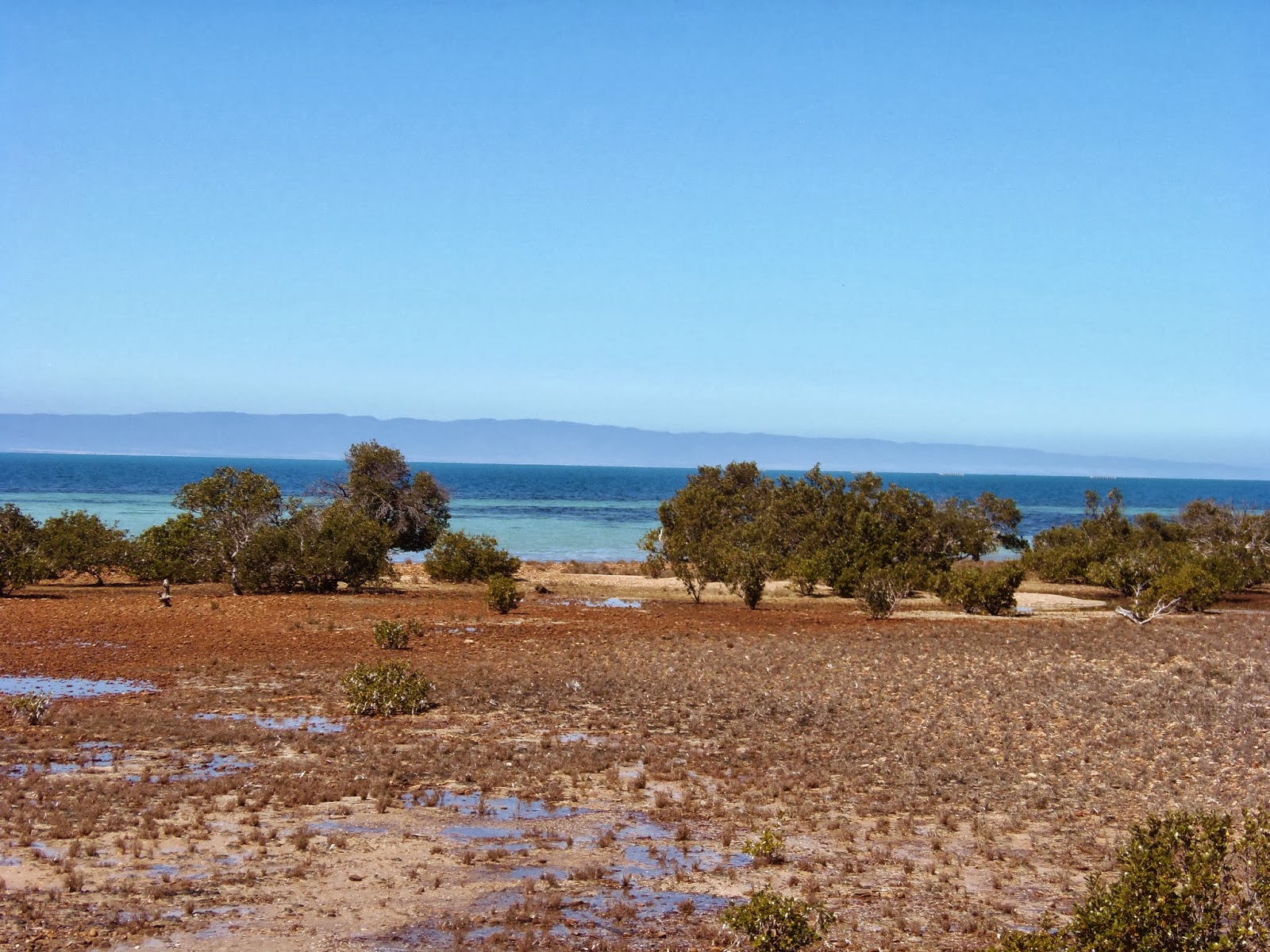
  Fitzgerald Bay turned out to be a far better choice and I wished that I had come here first. The clear, bright, blue, waters of the gulf where pleasantly presented from atop the hill behind the shoreline. A rough track, that continued to narrow as I went, led for a kilometre from the end of the bitumen to about 6 separate areas, suitable for camping, scattered next to the shore. Trouble was all but one or two were already taken so I grabbed what I could get. The beach was unusual, rather than sand the foreshore was made up of rounded stones that extended well into the water. In addition, a line of trees stretched along the beach about halfway between the bank and the water. I later found out that they where partially submerged when the tide came in. The weather has improved and I enjoyed it here sitting in the afternoon sun.
  Well dear Reader, that completes my circumnavigation of the Eyre Peninsula that has taken almost 3 weeks. I did like the secluded beaches and the fact that I could enjoy them mostly without company. The lush farmlands and pastures, the type country and the weather pattern at this time of year reminded me of Tasmania. I recommend this trip to you but suggest it be better undertaken a little later, perhaps mid to end October so as to miss the rain, wind and cold nights.
  Tomorrow I shall head via Port Augusta to Port Pirie on the eastern side of the Spencer Gulf and the northern part of the Yoke Peninsula.


PORT GIBBON and COWELL SA

   Does this sound familiar? A lonely signpost on the Hwy pointing to a gravel road that seems to disappear into the distance but in fact leads to a wide, open beach with rugged headlands and white sands. In the case of Port Gibbon a few cottages atop the low cliff and a small campground near the beach complete the scene. The weather is still bad, windy with rain on and off however, I did get a chance to explore the deserted beach. I liked being able to sit there by myself and contemplate what it was like when Matthew Flinders charted this part of the Spencer Gulf.
  The township of Port Gibbon that once existed, was surveyed in 1915 and was needed as a place to ship wheat from the nearby Elbow Hill and Carpa districts to markets elsewhere. In the early days two companies operated a chute to slide bags of wheat down the cliff face to a large dinghy which was then rowed to a ketch waiting in deeper water. As the district developed more wheat  had to be shipped and so the shipping facilities needed to be upgraded. A port facility was built with goods, wheat and superphosphate storage sheds and a jetty.Tram lines where laid from the wheat sheds to the end of the jetty where the Ketches now waited to be loaded. The loaded tram trucks were started from the sheds and down the steep the incline to the jetty under gravity with the brakes on most of the way. The Port is now obsolete and only a small portion of the jetty remains. Two plaques near the jetty recorded shipwrecks. the "Lillie Hawkins" that ran aground in 1917 and was wrecked without loss of life and the schooner "Milford Crouch" in 1959 when 5 died including the captain.


 When I first arrived here on Thursday there was only one other Caravan, next day there were 5 and it is getting crowded. Since it was "Pension Day" on Monday I will be here until then.


  I am badly in needed of a shower and there is a Caravan Park at Cowell, a small fishing village just 20 kms further on via the dirt "Ketches Scenic Drive" that follows the coastline. Nothing much to say about Cowell, friendly enough with a few old buildings, a reasonable feed of fish and chips and an overpriced Van Park.